I’ve made this trip often, so I thought that it might be time to journal the drive. We’ve changed our route over the years, as new highways now bypass some of the little towns. The new routes take less time with the elimination of traffic lights but have lost the chance to view the environs of these towns. Along the way, many interesting places beckon us to explore rather than stay on course for our destination.
We start our journey on my least-favorite highway, the congested Route 95, which is a direct route, if nothing else. At Delaware, the highway splits and Route 495 provides a pass around Wilmington. For a few miles, we see expansive views of the Delaware River, bridges, factories, ship yards, refineries and a big hill where trucks haul trash to the top. With major construction on-going, we navigate through the cattle shoots, jostling for a place on the highway with 18-wheelers.
Chesapeake & Delaware Canal Bridge
Opened in 1995, this bridge is one of the first of its kind in the area. A concrete and steel cable-stayed bridge, it spans the Delaware Canal, which connects the Chesapeake Bay to the Delaware River.

Just off the bridge, fields of corn alternate with suburban sprawl, box-like newer construction–single family and apartment complexes. Scrub forests and mixed pine and deciduous woods fill much of the landscape.
The Chesapeake Peninsula is coastal plain, which is a sandy, flat area, and the view from the car are fields of crops and outcroppings of forests in unpopulated areas. Small and large stands selling fruits and vegetables regularly appear along the highways. Along Route 13, shopping districts and homes have sprawled over some the farmlands in the last twenty-five years.
Ocean City, Maryland
Ocean City is a popular seaside resort for folks who live in the Mid-Atlantic region. Even though I have lived just three hours from this town, this will be my first visit. Our family vacationed at the Jersey Shore, specifically, Cape May. On this trip I thought it was time to stop at Ocean City, lured by the chance to walk along the lively 3-mile long boardwalk. After sitting in the car, will be good to get out and smell the sea air.
This slideshow requires JavaScript.
The Ocean City website listed a variety of events in the city: fireworks, concerts, movies and laser light shows.
Berlin, Maryland
A short drive from Ocean City, we stopped for lunch in the historic town of Berlin. The residents have restored the buildings along the main streets, where eclectic gift and antique stores feature displays in their windows. The tree-lined streets, Victorian lanterns and planters filled with flowers made this town an inviting stay. Several restaurants, such as the Drummer’s Cafe, Rayne’s Reef Luncheonette and SiCuli Rustic Italian offered a variety of choices for lunch. We ate at The Globe, once the neighborhood movie theatre and enjoyed a tasty lunch while watching an old-time flick.
This slideshow requires JavaScript.
Crisfield, Maryland and Tangier Island
Blog post, Tangier–Virginia’s Island Lost in Time, describes our visit to Tangier Island in 2011.

Parksley, Virginia

Parksley was a planned community as a result of the railroad constructions on the Eastern Shore and is representative of the small town atmosphere of that era. The commercial district in the center of town has a number of shops and restaurants. Victorian houses stand along the shaded streets.
Founded in 1988, the Eastern Shore Railroad Museum is housed in a restored train station. Around the station, railway cars, such as the Fredericksburg and Richmond Post Office Car and the Wabash Caboose rest on tracks.

Onancock, Virginia
Onancock comes from the Indian word “auwannaku” meaning foggy place, but it was a bright sunny day when we arrived. This town offers much to see with self-guiding walking tours past historic homes and lovely gardens and places to rent boats and kayaks. A ferry operates out of Onancock Creek to Tangier Island. For over a century, the Hopkins and Brothers operated a mercantile store, as Onancock had been a busy center for trade. Renovated and moved, the interior of the building still maintains the look of a country store. A number of old-fashioned general stores still remain in operation along our route, which inspired this post on the political and social aspects of losing the general store in the American small town.
This slideshow requires JavaScript.
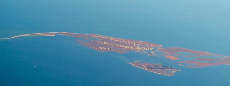
Chicotegue Island, Virginia
Spending just a day on Chincoteague Island, we were rewarded with a serendipitous experience. Chincoteague, on the eastern shore of the Del Mar Peninsula, is best known for the wild ponies, whose ancestors survived a wreck of a Spanish Galleon, or one of the legends would have us believe. Turned out the egrets carried the day.
Cape Charles, Virginia
Turning off 168, about twenty miles from the Chesapeake Bay Bridge, we found this attractive little gas station. Read more about this station and others like it at: Nostalgic Memorabilia: Filling Stations of the 1920s.

Gas Station on Route 184
We explored the bay-side town of Cape Charles. For many years the town had been the terminal of the Little Creek Cape Charles Ferry, which provided car ferry service to Norfolk and Hampton. Now an expansive beach runs the length of the village. Many of the homes date back to the early 1900s, and the town center has a distinctly small town main street.
Chesapeake Bay Bridge
Across the mouth of the Chesapeake Bay the bridge meets the Atlantic Ocean and opening of the Chesapeake Bay. About 17 miles long, the bridge connects Cape Charles with Norfolk.

The Bridge-Tunnel, opened in 1964 and considered the largest bridge-tunnel complex in the world, consists of low trestle bridges, two suspension bridges and two tunnels, each a mile long under the shipping channels.
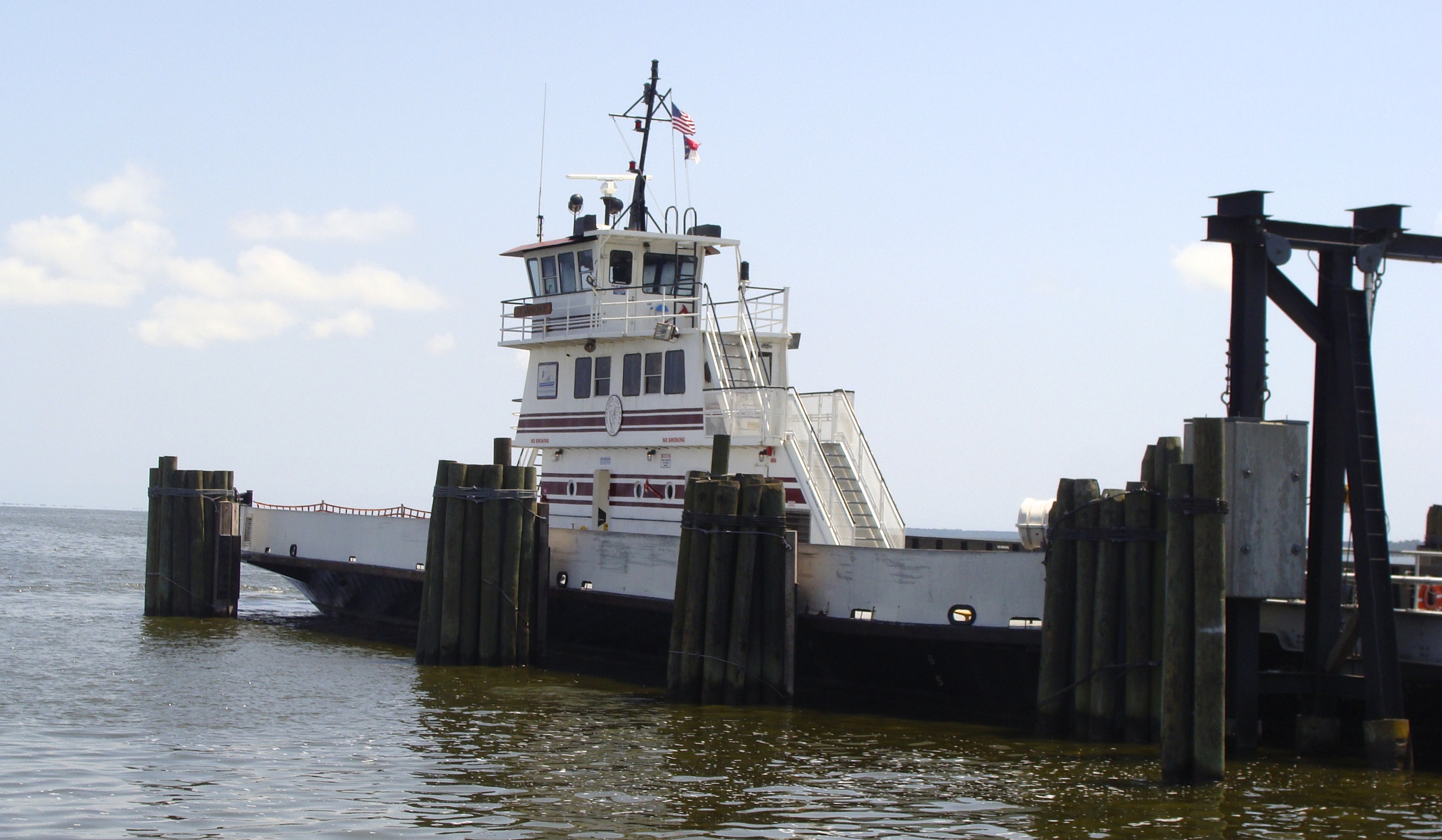
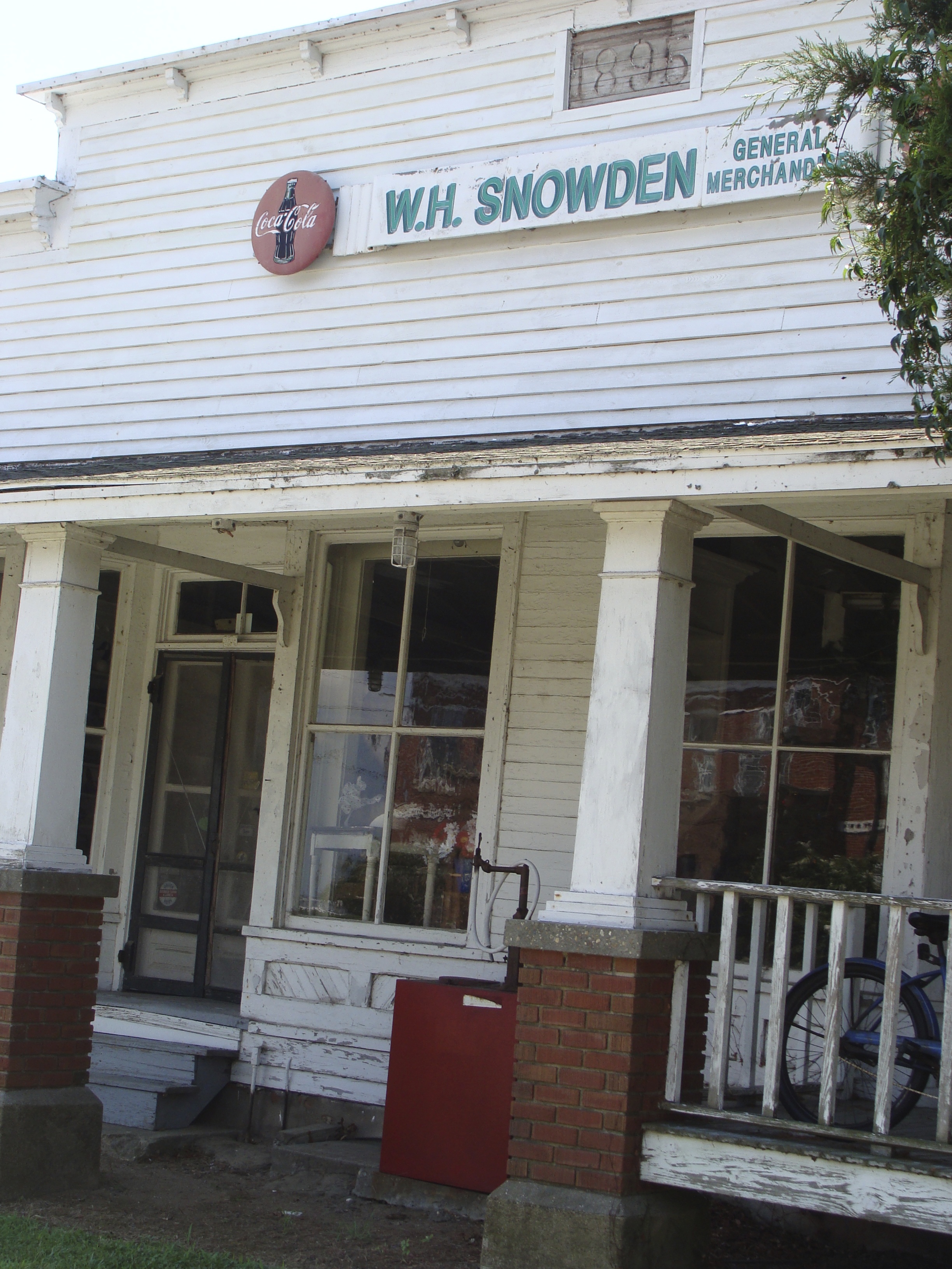
Currituck, North Carolina
Just off of Route 168 and situated on the Currituck Sound, the town is the landing for the Knotts Island Ferry, which offers a free shuttle to Knotts Island. The town has a few brick buildings including the Courthouse and Jail house, dating back to 1820. W. H. Snowden’s General Merchandising Store was closed but I could peek in the windows and see that it still retains the look of a country store.

Knotts Island Ferry

Peck Basket, Moyock, North Carolina
One of our favorite stops along Route 168 is the Peck Basket. Years ago the little store was not more than a shack but always had an eclectic array of items to gaze at or to buy. In its new site, has taken on the ambiance of a general store, replete with pot belly stove and old-time counters and open shelves.
This slideshow requires JavaScript.
Wright Memorial Bridge, North Carolina
Built in 1966 and over a mile long, this bridge connects the Outer Banks to the mainland. Getting over the bridge on a Saturday is an exercise in patience as traffic backs up along 168 all the way to the Cotton Gin. The backup continues along Route 12, the only highway to the upper end of the island.
Duck, North Carolina
Beach and bay scenes in Duck.
This slideshow requires JavaScript.
Elizabethan Gardens, Manteo
Best described on their website:
Fanciful and elaborate gardens were kept to entertain Queen Elizabeth I during her reign. Our garden was created for your enjoyment, and as a living memorial to the time when Sir Walter Raleigh’s lost colonists lived in this very place over 400 years ago. Inside our brick-walled gate you’ll find a wonderful collection of Renaissance statues, a sound-front Elizabethan-gazebo, a sunken Elizabethan knot garden – all adorned by an ever-changing palette of year-round color from hydrangeas to native plants, perennials and camellias on ten sound-side acres.
This slideshow requires JavaScript.
The Lost Colony, Manteo
One evening we attended The Lost Colony, the longest-running outdoor theater. I especially enjoyed the 16th century choir music and the Native American dancers, who flung the sand in arches over their heads. Special effects, fire torches and guns blasting, added unexpected excitement and action. The story, an historical drama rather than a recreation of actual events, piqued my interest and I followed up with some research on my own. Our family members were friends with the “Queen,” played by Diana Cameron McQueen, so we stayed after the performance to meet and talk with the cast members.
This slideshow requires JavaScript.
0.000000
0.000000


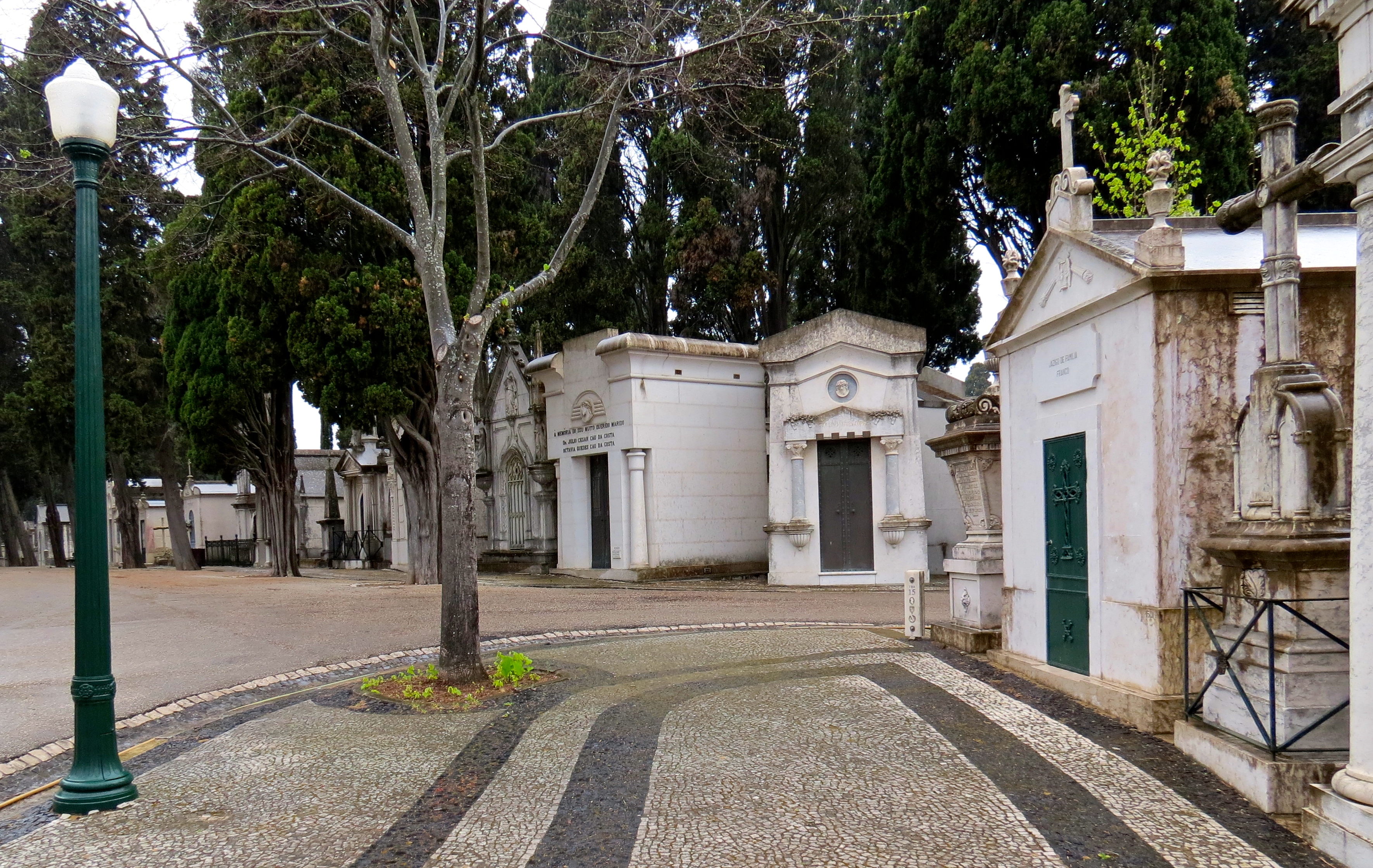
 I stayed on the trolley, with a mysterious transfer to another, to the end of the line. I never did quite figure out their system, but did reach the last stop, the Prazeres, for my verified “Dark Tourism” experience. Ironically named “Cemetery of Pleasures,” the spot has an otherworldly feel, the rainy day contributing to the misty atmosphere. Lines of cyprus trees stretched toward the sky, breaking up the line of marble buildings. This cemetery reminded me of our visit to the